
Stay legal with Fishdope’s maps of recreational fishing closures and important boundaries.
Fishdope’s Closures layer shows all of Southern California’s important closures and spatial regulations to help you fish legally.
We show marine protected areas (MPAs), 2024’s new Groundfish Exclusion Areas (GEAs), federal depth waypoints like the 50 fathom boundary, the US-Mexico Border, Mexico’s Island Biosphere Reserve areas, and even the 12-nautical mile limit where you need FMM visas in Mexican waters.
Groundfish Exclusion Areas and Federal Waypoints
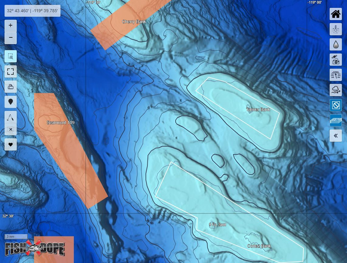
Fishdope’s closures layer showing GEAs (orange) and 50-fathom boundary (white lines) around Cortes and Tanner Banks
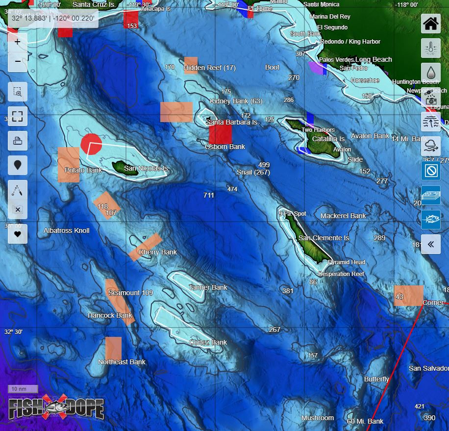
The new 2024 groundfish regulations re-opened large swaths of the former Cowcod Conservations Areas that had prohibited bottom fishing outside 40 fathoms at many popular offshore banks and islands. The Osborn Bank, Tanner and Cortez Banks, and large areas around Santa Barbara Island, Hidden Reef, and San Nicolas Island are now open to bottom fishing once again after being off-limits for over 20 years.
The cowcod zones have been replaced with smaller, more targeted Groundfish Exclusion Areas (GEAs) that prohibit bottom fishing but allow fishing for pelagics like tuna, yellowtail and marlin. Fishdope’s closures layer shows these areas as orange polygons to help you avoid a costly ticket and focus on other open areas.
Fishing for rockfish also comes with some seasonal depth and species restrictions based on federally-determined waypoints that approximate depth contours along the coast and around islands.
Our in-house GIS expert plots these federal boundaries each year so you don’t have to wonder whether your favorite rockfish spot is on the right or wrong side of the line – it’ll be easy to see on our Closures layer.
For 2024, we’ve got the 50-fathom boundaries mapped out with white lines so you can see where you’re allowed to bottom fish during the seasonal restrictions: shoreward of the boundary allowed July 1 – Sept 30 (seaward prohibited), and seaward allowed Oct 1 – Dec 31 (shoreward prohibited). And if the boundary is different next year, we’ll have it updated for you!
Marine Protected Areas (MPAs)
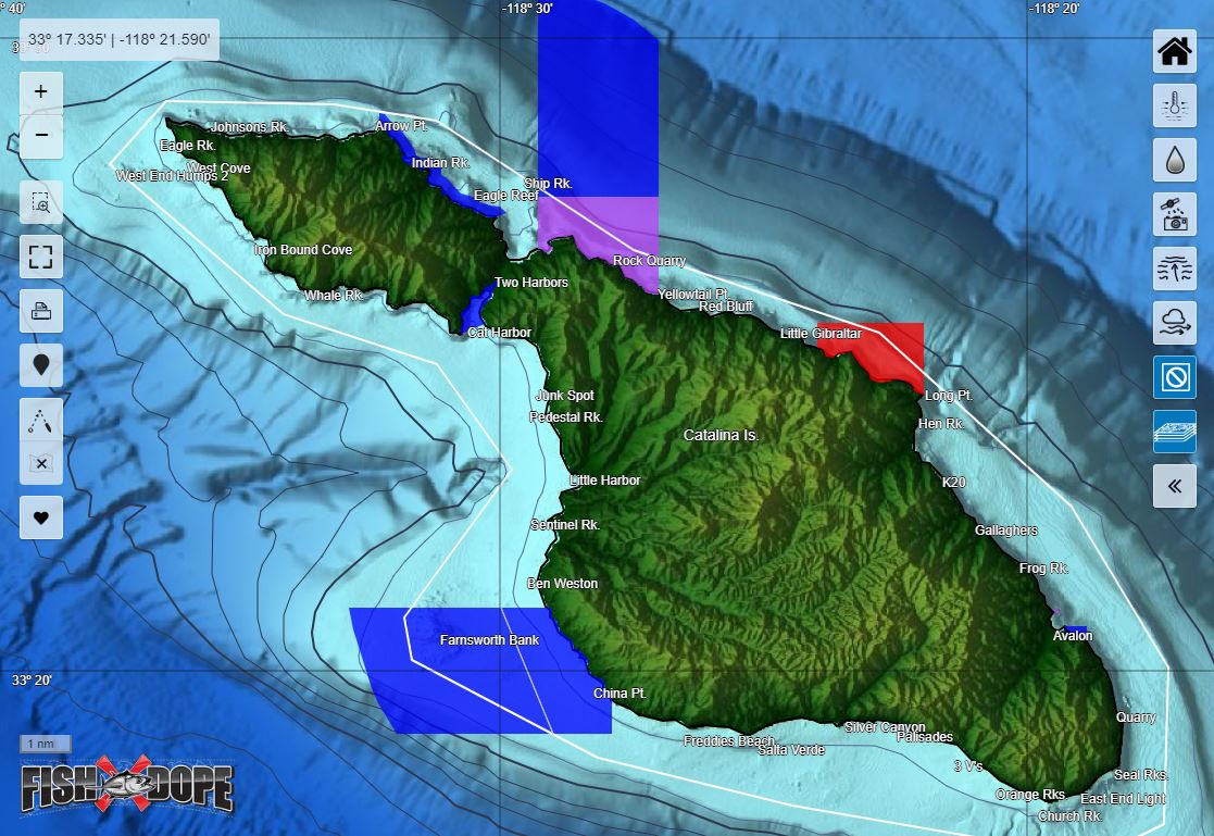
Fishdope's Closures layer also shows you MPAs such as fully-closed State Marine Reserves (SMRs, red polygons) and Conservation Areas (SMCAs, purple) that prohibit all recreational fishing, as well as partial-take SMCAs (blue) that allow some recreational fishing but with certain restrictions on methods and species. Be sure to check the specific regulations for any MPAs you're fishing around to know what you can and can't take.
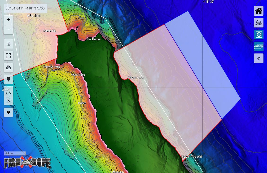
US Navy Security Zones at San Clemente Island and San Nicolas Island
Our new high-definition bathymetry maps for San Clemente Island and San Nicolas Island show US Navy security zones around each island. We show you which zones are permanently off-limits and where you are allowed to transit through certain areas (with permission) but not stop and fish.
Mexico's FMM zone and Biosphere Reserve areas
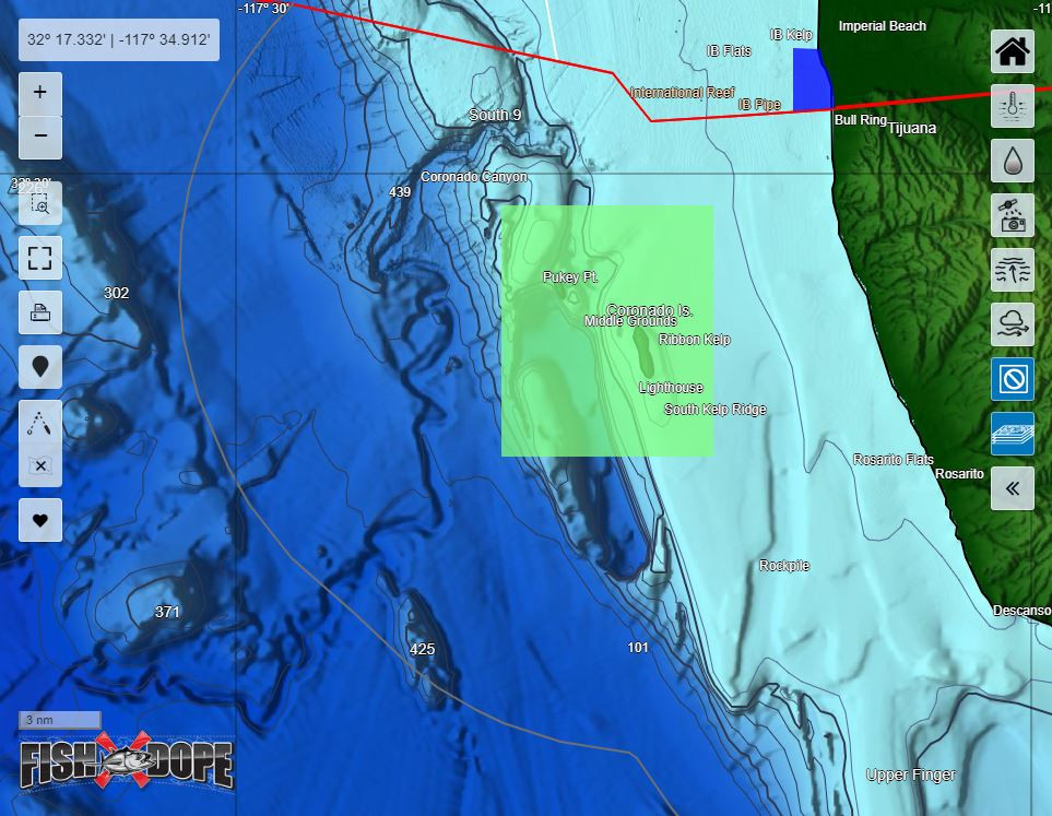
One of our most frequently asked questions is, "What permits do I need to fish the Coronado Islands?" Fishing in Mexico comes with its own set of regulations and restrictions to follow, such as following different size and daily bag limits south of the US-Mexico Border (red line), needing a Tourist Card (FMM) visa within 12 nautical miles of Mexican land or islands (dark gray line) and special bracelets or an annual pass for its Biosphere Reserves around islands (green polygons) off the coast. We provide our members with instructions for how to purchase these permits and show you the areas where you need them right on our charts.